Modeling Services
Our modeling capabilities are extensive and include water resources, infrastructure, ecological, coastal engineering processes, and port and harbour design applications. These are often used jointly with other service lines, such as ecological assessments, water quality sampling/monitoring, or infrastructure services. Applied Ecology is able to leverage staff with programming and scripting experience to expedite analysis, reporting, and data collection efforts, all while reducing human error. We understand cost is often the number one factor why projects aren’t implemented. With the help of our modeling services, we can guide clients on what their priorities should be, whether it is for their data assessment, monitoring, or even retrofit projects. Specific modeling services we have provided include:
- Watershed Loading Model Development
- BMAP Load Allocation and Prioritization Models
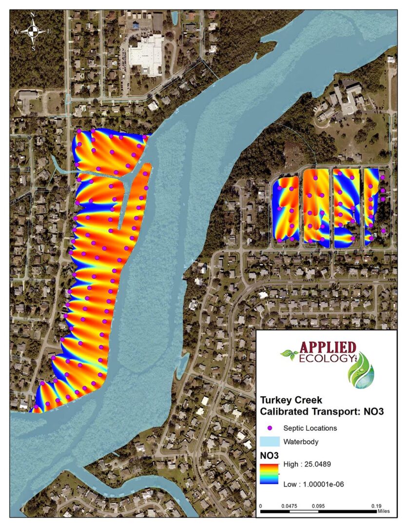
- Groundwater Modeling
- Water Quality (EFDC/HEM3D)
- Coastal Processes (CMC/Delft3D)
- Hydrologic modeling, including ArcHydro
- ArcGIS-Based Nitrate Load Estimation Toolkit (ArcNLET) Groundwater Model
- 2D & 3D Terrain Modeling and Canopy Analysis
- ArcGIS Desktop/Pro Custom Tool Development
- Geoprocessing Services Development for the ArcGIS Online Environment