C. W. B Young Regional Reservoir Environmental Seepage Assessment Services
The C.W. Bill Young Regional Reservoir (Reservoir) has been in operation since 2005 and is in compliance with the Department of Environmental Protection (DEP) and Hillsborough County Environmental Protection Commission (EPCHC). As part of the compliance requirements, ecologic and hydrologic monitoring of the surrounding environment is necessary to document any adverse effects and implement management options as deemed necessary and prudent. Applied Ecology is the lead in the ecological analyses and photointerpretation tasks of this four-year monitoring project. Wetland Affinity Scores (WAI) are computed by AEI per site location (quadrat) for the dry and wet season evaluations.
Summary statistics are calculated for the period of record (2001 to present), baseline (2001 to 2005), and operational monitoring period (2006 to present). Each of the 32 quadrats and independent plant strata (groundcover, shrub, and tree) are subjected to statistical analyses to detect lower WAI scores or decreasing trends that would indicate more hydrophytic vegetation or a change in hydroperiod to wetter conditions during each season for the entire period of record and for the operational monitoring period. GIS and Remote Sensing tasks under this project include a visual interpretation of Color Infrared (CIR) images & digital analysis of the Multispectral (MS) imagery, using the Normalized Difference Vegetation Index (NDVI) are examined for evidence of land use and land cover changes over time.
Additionally, AEI assessed the effectiveness of the current water quality monitoring program by identifying redundancies in monitoring and providing recommendations for modifications to enhance overall performance. The water quality evaluation focused on visual data techniques, regulatory standards, and statistical data analysis with the main goal of determining if water from the Reservoir is impacting the quality of groundwater adjacent to the Reservoir. All results from the aforementioned analyses were submitted in an annual report to Tampa Bay Water, which was used for permitting compliance.
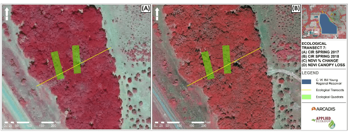
Color-infrared (CIR) aerial imagery for Ecological Transect 7 during (a) Spring 2017 and (b) Spring 2018.
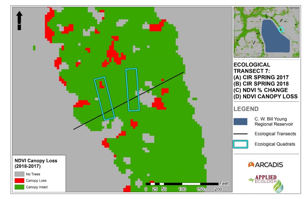
Change detection for Ecological Transect 7 using normalized difference vegetation index (NDVI) from Spring 2017 to Spring 2018 for canopy cover loss.
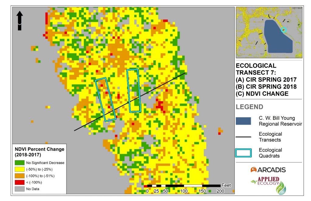
Change detection for Ecological Transect 7 using normalized difference vegetation index (NDVI) from Spring 2017 to Spring 2018 for percent change in canopy cover.
Client:
- Arcadis U.S., Inc. for Tampa Bay Water
- Deborah Daigle (Principal Hydrogeologist, Arcadis) / Curt Wade (Reservoir Compliance Manager, Tampa Bay Water)
Project Duration:
- 2017 – 2021
Team Members:
- Dr. Claudia Listopad
- Danielle Huffner
- Kayleigh Douglass
Services Provided:
- Database Management
- Ecological and hydrological analyses
- Statistical Analyses
- Spatial Analyses
- Remote Sensing of Multispectral and Hyperspectral (historical) data
- Photointerpretation
- Reporting