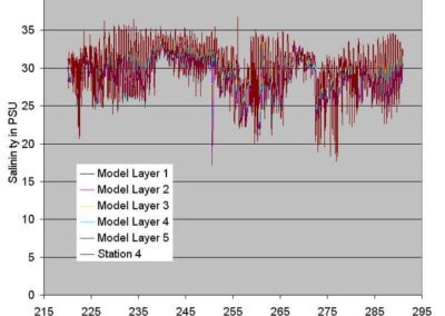
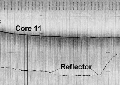
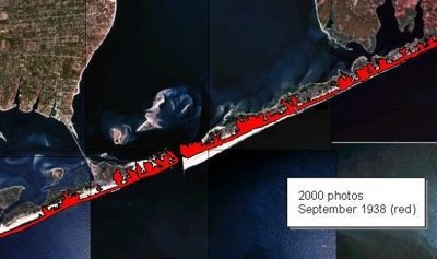
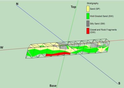
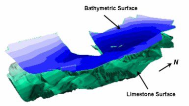
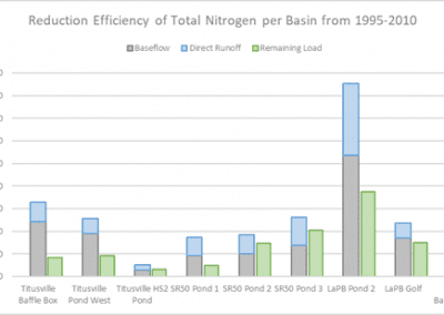
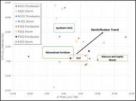
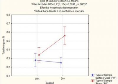
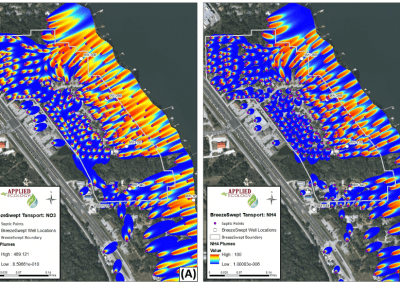
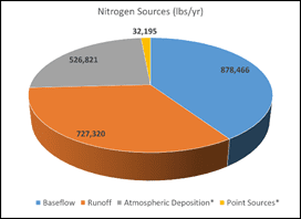
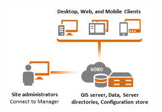
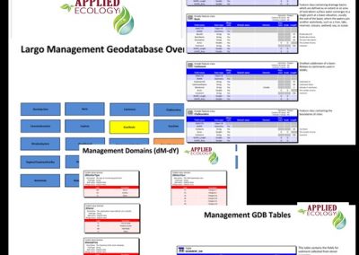
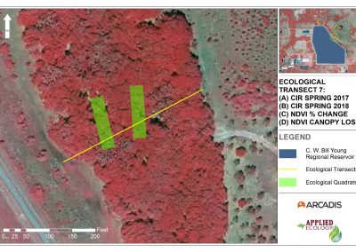
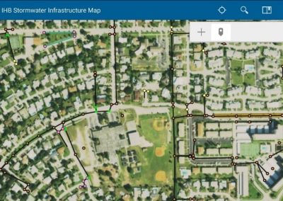
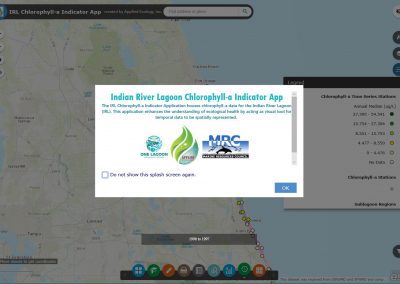
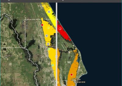
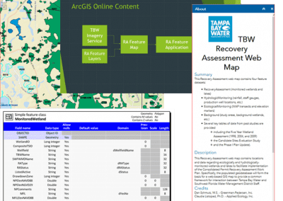
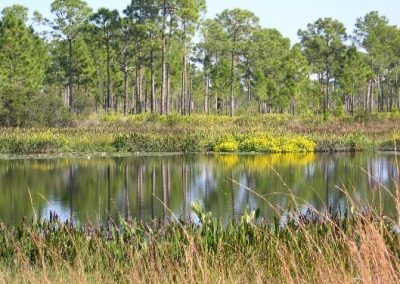
Portfolio AllContamination Assessment and RemediationEcologicalGeotechnicalGIS and Remote SensingWater Resources City of Cocoa Beach Muck CappingEcological, Environmental Engineering PFAS and Priority Pollutant SamplingContamination Assessment and Remediation, Water Resources Combining Geological and Numerical Models to Assess Sand Resources on the Inner Continental Shelf of Northeast FloridaWater Resources Hydrodynamic and Flushing Model of Lake Jesup, FloridaWater Resources Shore Protection Modeling: Portable Breakwaters on the Southeast Coastline of NantucketWater Resources Salinity Distribution and Flow Management Studies for Lake Worth LagoonWater Resources Seismic and Hydrographic Survey Jupiter/Carlin Shore Protection and Geotechnical ProjectsGeotechnical Geomorphic Investigation of Tidal Inlets: Applications in Coastal EngineeringGeotechnical Geotechnical Analysis of Ranch Road Lake Sand Mine Core BoringsGeotechnical Borrow Area 1 Geotechnical Investigation for the Town of Hillsboro Beach, FloridaGeotechnical Indian River Lagoon Storm Event Monitoring and Load CharacterizationWater Resources Groundwater Pollution: Engaging the Community in SolutionsWater Resources NPDES Phase II MS4 Permit Compliance SupportWater Resources Water Use Permitting Statistical Analysis SupportWater Resources Developing Data-Driven Septic Policy for the Indian River LagoonWater Resources SOIRL Stormwater Project Grant SupportWater Resources Huntington Lakes II Water Quality MonitoringWater Resources Model-based Basin Prioritization Effort for the City of TitusvilleWater Resources Using In-Situ Data for the Development of a Geospatial Watershed Loading Model for the U.S. Army Corps of Engineers Mobile DistrictWater Resources Groundwater Modeling and Source Study in the Turkey Creek BasinWater Resources Surface Water Quality Sampling for TMDL PrioritizationWater Resources Residential Stormwater Quality Evaluation for the Tampa Bay Estuary ProgramWater Resources Groundwater Sampling and Model for the Breeze Swept Subdivision Septic System ConnectionWater Resources Watershed Loading Model Development for the Indian River Lagoon TMDL: Spatial Watershed Iterative Loading Model (SWIL 1.0-3.0) and Outfall Prioritization ToolWater Resources Infrastructure Database Development, GIS System Setup, and Web Application for the City of RockledgeGIS and Remote Sensing CCAFS Infrastructure Survey and GIS IntegrationGIS and Remote Sensing Comprehensive Stormwater Assess Management Plan for the City of LargoGIS and Remote Sensing C. W. Bill Young Regional Reservoir Environmental Seepage Assessment ServicesEcological Database Design, Inventory, and GIS Web Application Development for the City of Indian Harbour BeachGIS and Remote Sensing State of the Indian River Lagoon Application (SIRLAP)Ecological Indian River Lagoon Ecological Health UpdateEcological Recovery Analysis Database Design, Creation, and Web ApplicationEcological T. Mabry Carlton Jr. Memorial Reserve WellfieldEcological